San Francisco is an urban anomaly. Within 49 square miles, there are more neighborhoods that feel like suburbs or beach towns than those of a true city. I myself live three blocks from the bay. My evening passeggiata takes in docked sailboats, rosebushes, Goldie the Bridge, and the waterside hill towns of Marin and the East Bay.

Perfect symmetry on the Matt Davis Trail

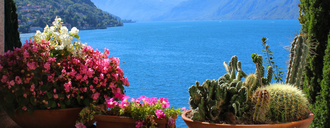
Poppy season on the Matt Davis Trail
We take advantage of our surroundings within the 7×7, but the major appeal to living in San Francisco is the abundance of nature just outside the city. We (and by we, I mean other, far more active people) put on padded bike pants on the weekends and bike over the bridge to Sausalito, on to Tiburon, or up and through the steep Marin Headlands or Mt. Tam, speeding along cliff roads faster than I am willing to drive. They ride for hours with mountain on one side, ocean on the other.
I am working my way up to that. For now, I am more than content with traversing all of the above by foot. So my version is this: I put on my yoga pants and a big rimmed hat, I pack my environmentally-friendly water bottle in my canvas bag (this is San Francisco, after all), and I set off on some of the most spectacular trails this side of Thailand.
We haven’t as much paid for our eight dollar parking at the Pan Toll Ranger Station before my friend jokingly asks if I want pancakes. Apparently there is an inn two miles in, where we can pretend to be famished and refuel on carbs and sugar. I refuse to fall in to the trap. Somehow, we get off the Matt Davis Trail from the get-go, but we are not complaining. We dive in and out of redwoods, a walk in the cool breeze, stepping over gnarly roots, and then long periods of sun on rolling hills, taking in the ocean views. We follow paths that shoot diagonally up steep green hills, dotted with yellow poppies, and we feel a little bit like Julie Andrews. We have been walking for two miles, according to my friend’s Nike app, and already I am feeling sluggish. The pre-recorded Nike woman orders us to ‘Resume workout!’ each time we pause to take in the spectacular, all-encompassing ocean views. We conclude that she is incredibly bossy and is no longer invited on our hikes.
We cross over what we assume to be the panoramic view road at one point, and we have no idea if we are headed in the right direction. Mt. Tam and the Marin Headlands lack cell service, so we leave it to the ocean to guide us home. One couple is coming up from that way yonder, and we ask them where their trail leads. ‘Canada,’ they reply. Considering the vastness of these hills, we would not be surprised. They confirm that we are headed in the right direction for the Matt Davis Trail, and we celebrate the hills that look like tennis balls bouncing straight into the ocean, a vision I might compare to an IMAX movie. We can see Stinson Beach, and soon enough, we can also see San Francisco itself. Our path hugs the aforementioned ‘tennis balls’ of Mt. Tam. If I want to look out at the ocean on my right, I have to actually stop walking and purposefully turn my body. If I accidentally step one extra foot off the 24-inch wide path, I will be the least graceful Julie Andrews that ever were, tumbling down the hills instead of enthusiastically running across them. I feel like I am on the edge of the globe itself, and every time I think we have reached the final stretch of the trail, there are about 6 more tennis ball hills before me. In the heat of the sun, I start to crave fresh mediterranean meals, maybe pasta pesto with lots of fresh basil. We reach the last stretch, where the redwoods envelop us, and I welcome the cool breeze. Now I crave trail mix, peanut butter and jelly, anything that takes me back to summer camp and days spent skipping over fallen trees in the woods. When we finally reach Pan Toll Station again, we have been hiking for about 8 miles, and we would have eaten just about anything. We race home, where Tartine bread is waiting.
Hill 88 in the Marin Headlands is another magnificent coastal hike. We began at Rodeo Beach in the mid-morning, where SF-ers were already in the water with their surfboards. The first two miles are a steep incline with quite a few steps, but the views of the city and Ocean Beach are worth it. At the top of the trail, we were rewarded with 360 degree views of the Marin Headlands, and the second half of the trail is a leisurely stroll down hill on a wide dirt path. Both Hill 88 and the Matt Davis trail are ideal for perfectly clear days. If shrouded in fog, neither are nearly as enjoyable, and I assume that my endorphins would take a beating as well.
After a hike in Marin, it doesn’t feel right to race straight back to the ‘city.’ I feel strongly that I have to re-acclimate my body slowly, perhaps with lunch or dinner at Bar Bocce in Sausalito. This world away is so close to the city that I can even go home, shower, and be back on the bocce court within the hour. How many other ‘city’ residents can pack this much nature into one day?

From Stinson to San Francisco: spectacular coastal views

Distant city views

On the Matt Davis trail (or so we thought)

Matt Davis Trail


Zooming in on SF from a Mt. Tam peak

Rolling hills on Mt. Tam

At one point, the trail crosses the panoramic road.

Tennis ball hills

Matt Davis Trail


Poppies

At certain points, we’d find ourselves underneath redwoods deep in the forest, and then we’d pop out to these views again

Matt Davis trail

In the forest on the Matt Davis trail


Rodeo Beach

Rodeo Beach

Hill 88 in the Marin Headlands

The second half of the Hill 88 loop

The perfect evening for Bar Bocce

Sunday evening at Bar Bocce
Categories: California, Travel


Thanks for the fresh and sunny walk! Very expressive photo-feature!
Ive been wanting to travel to and possibly move to San Francisco, so this post definitely catered to that desire. Thanks for sharing and great photos!